Overview:
Satellite imagery and maps.
Search for more than 8.000.000 geographic entities worldwide.
Atomic Clock time synchonization (interval: 3 minutes).
Statistical population counter.
Colour adjustment for satellite images.
Different sources merged together. Addons like: Google maps, Yahoo images search, geolocated WEB pages, ..., are driven from application.
See also: GeaBios (Wikipedia)
| latitude: | 23:30.5S=-23.50833= 23:30:30S=-23:30:30 |
| longitude: | 76:30.5W=-76.50833= 76:30:30W=-76:30:30 |
Report Bugs ->
About speed: service is running on 2x550 MHz 20th century machine with 2.5 MBits wireless connection. Sometimes we're slow (a lot of concurrent requests:-)
This page could look like: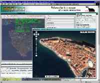
No pop-up windows, internal movable frames (like windows) are created for external sources, like Google Maps, Yahoo image search, etc.
You might have a problem with this kind of windows, we tested this stuff on IE 5.5+, Mozilla 1.7+, Firefox 0.9+, Opera 8+ and Netscape 8+.
Click to see:
Pyramides,
Stromboli,
Ayers Rock (Uluru),
Bora-Bora,
Rarotonga,
Tahiti,
Copacabana,
Gibraltar
Show & Mark:
Mt Everest,
Aconcagua,
Kilimanjaro,
Mt Saint Helens,
Ararat,
Eiger,
Mt. Fuji,
Yosemite
Outdoor connection:
Baikonur Cosmodrome,
Cape Canaveral,
Jiuquan Satellite Launch Centre (China),
Show:
Maps Only,
Satellite Only,
Both
New start position:
Istra Peninsula (reload page with new parameters)
Tips:
Lond,UK means London and Londonderry and London Conley
Palo,us means Palo and Palo Alto and Palo Blanco and ... from United States
Do not use local character set (ASCII only)
Write (no case sensitive): Dusseldorf, Koln, Orebro, Are, Lwow, Cacak, Ajdovscina, Sao Paulo, ...
Why? Different people from different countries with different keyboards are using this search
Search is limited to 25 hits!! In result set, non-ASCII characters are written as ? (question mark).
Geolocate URL:
Add the following meta tags to the <head> section of your web page (see above Export position, by selecting, the application will fill lat,lon):
<meta name="ICBM" content="LONGITUDE, LATITUDE">
<meta name="DC.title" content="THE NAME OF YOUR SITE">
and submit page to GeoURL (new window)
Add direct link(click to fill the appropriate - wysiwyg):
for ordinary html page:
<a href="http://www.geabios.com/html/services/maps/PublicMap.htm?lat=______&lon=______
&fov=______">GeaBios - show location</a>
for Wikipedia:
[http://www.geabios.com/html/services/maps/PublicMap.htm?lat=______&lon=______
&fov=______ GeaBios] - show location
or templates:
{{coor dm||||||}},
{{coor dms||||||||}}
then just copy and paste.
What is fov? Field of view in decimal degrees.
Simple overview map: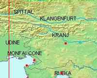 |
Visible Bands: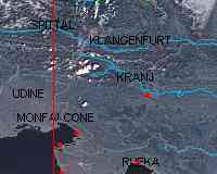 |
Visible & IR Bands: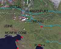 |
| And different combinations on the fly from different WMS and WFS servers. | ||
Coming soon:
Online transformation for different source projections to target projection, on client. All the pictures below are created as a sandwich of reprojected images to target projetion (see data), written in action script, embedded on web page (without proxy server).
WMSVER |                    NAME                     |  AREA      |    PROJ     |      COMMENT
-------+---------------------------------------------+------------+-------------+-------------------------
1.0.0  | Slovenia                                    | Slovenia   | EPSG:2170*  |
1.1.1  | WMS-Dienst: pgo                             | Austria    | EPSG:31287  |
1.1.1  | Atlas životního prostředí v Praze           | Czechia    | EPSG:102065 |
1.1.1  | SGS Geology and Tectonics                   | Switzerland| EPSG:4326   |
1.1.1  | IGME 1:1M Geological Map (Spain)            | Spain      | EPSG:23030  |
1.1.1  | 1 to 250000 scale geological map of Hungary | Hungary    | EPSG:4326   |
1.1.1  | GBA Bedrock Geology and Tectonic Lineaments | Austria    | EPSG:4326   |
1.0.0  | DEMIS - World Map                           | World      | EPSG:4326   | 'Hillshading' background
-------+---------------------------------------------+------------+-------------+-------------------------

Target projection:
===================
EPSG:102017

Description of projections:
===========================
    PROJ    |             DESCRIPTION                 |            PROJECTION's NAME        |          ELIPSOID
------------+-----------------------------------------+-------------------------------------+------------------------------
EPSG:2170*  | MGI / Slovenia Grid                     | Transverse Mercator                 | Bessel 1841
EPSG:4326   | WGS 84                                  | Lat/Lon                             | WGS 84
EPSG:23030  | ED50 / UTM zone 30N                     | Universal Transverse Mercator (UTM) | International 1909 (Hayford)
EPSG:31287  | MGI / Austria Lambert                   | Lambert Conformal Conic             | Bessel 1841
EPSG:102017 | North Pole Lambert Azimuthal Equal Area | Lambert Azimuthal Equal Area        | WGS 84
EPSG:102065 | S-JTSK Krovak                           | Krovak                              | Bessel 1841
------------+-----------------------------------------+-------------------------------------+------------------------------
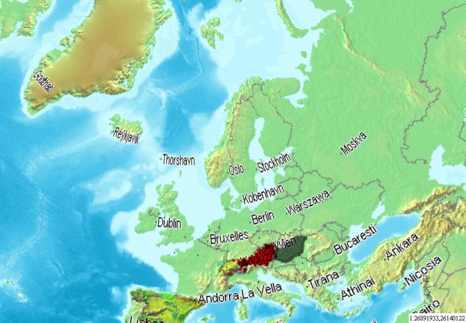
From Spain to North Pole (Scale approx. 1:27.000.000)
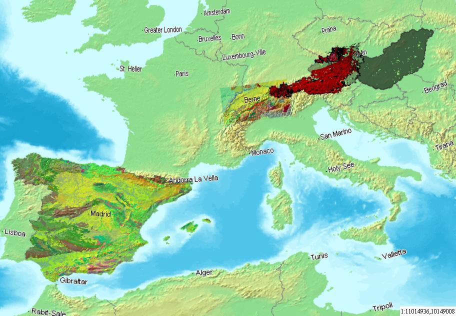
West Mediterranean (7 WMS sources, all together reprojected to Lambert Azimuthal Equal Area Projection) (Scale approx.: 1:11.000.000)
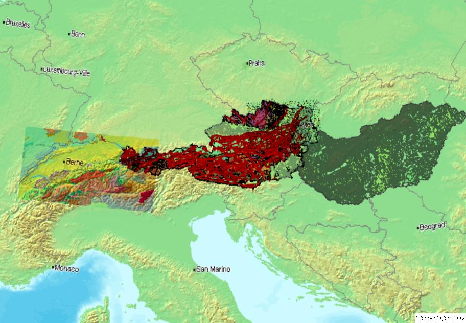
From Jura to Tatre - rotated (Scale approx.: 1:5.600.000)
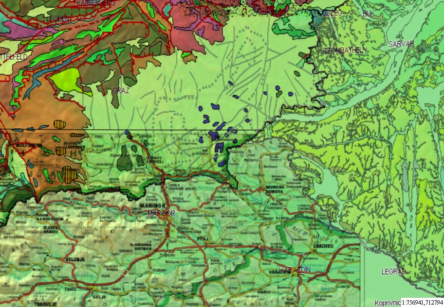
Austria, Hungary, Slovenia - triangle (Scale approx.: 1:750.000)